Did you there are soil maps for most counties in the U.S.? And did you know you can look up the soil type by zip code or even address in detail online?
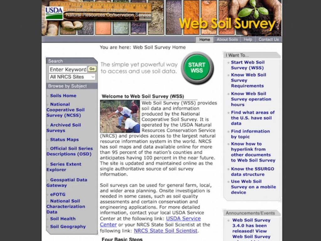
The Web Soil Survey is a powerful tool that allows you to take an in depth look at your land’s soil type and use that information to plan out pasture improvements or establishments.
It’s called the USDA Web Soil Survey and it’s completely free to use. You can print out the USDA – you can even print out detailed and customized reports, which include the USDA soil maps, for later use.

Accessing soil maps by zip code or location
All you have to do is go to the NRCS Web Soil Survey website, plug in your address or zip code, and then you’ll be able to look at the soil map of your selected area with all the different soil types present.
At any time you can add parts of this report to your “shopping cart” to be included in your print out at the end for future reference when considering plantings and pasture renovations.
Also available in this report is a list of Forage Suitability Groups. These are classified as strings of numbers and names. These can also be added to your print out, but either way the numbers are what you’ll want to take note of.

Finding plant species by soil type
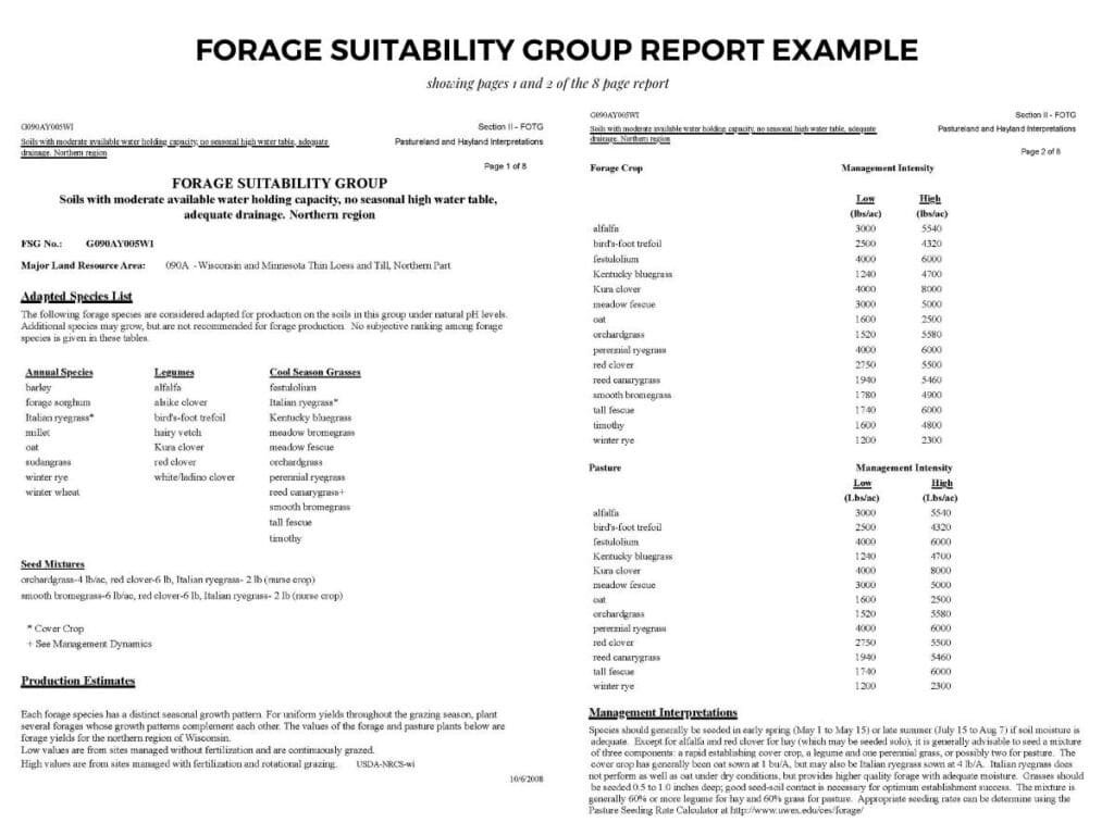
Once you have your forage suitability group numbers you can look them up in the USDA’s Field Office Technical Guide for your particular state and county.
There, you’ll find documents about your particular Forage Suitability Groups, including an adapted species list that does well with your particular forage and growing area, the water holding capacity, forage crop production estimates and a lot more.

Web Soil Survey Tutorial
Check out my full walkthrough of the USDA Web Soil Survey and how to find your forage suitability groups below.
Need more help finding your Forage Suitability Groups?
If you’re not able to find specific information for your county on the Web Soil Survey, your best bet would be to reach out to your county conservationist, who will be able to help you determine next steps and suggest additional resources.
You can find your local conservationist in the USDA’s service center database.
How to find your soil maps with the Web Soil Survey
Here’s a quick guide on how to access your USDA soil map and types for your farm or zip code using the Web Soil Survey, and then find a list of recommended plant species based on your soil type:
- Go to the Web Soil Survey website
Go to the website here and click on the green button labeled “Start WSS”
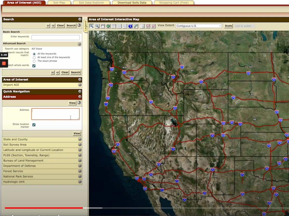
- Go to the “Area of Interest” Tab
This is located on the top left side of the website and should be the first tab.
- Select the “Quick Navigation” Section
Enter your address of your farm or ranch, or zip code
- Select the AOI Selector Tool at the top of the map to identify where you want to create your soil map
The selector tool has two options, both are small squares with the letters AOI and red shapes. Then use the tool to draw your desired location you want to map for your soil types.
- Click on the “Soil Map” Tab
Once in the soil map area it will show you a map of your different soil types and on the left side bar will list the soil types, along with their symbols, acres, and percentages on the map.
- At the top of the screen select “Add to Shopping Cart”
This will add your soil map and types to your custom soils report.
- Click on the “Soil Data Explorer Tab” and then the “Soil Reports” Sub-Tab
Follow these steps to access your pasture plant species lists.
- On the side bar, select “Land Classifications” and then “Forage Suitability Groups”
The Forage Suitability Groups will show you the report codes based on your soil types.
- Click “Add to Shopping Cart”
This will add your Forage Suitability Groups list to your custom soils report.
- At the very top of the screen, click on the “Shopping Cart” Tab
Download your custom soil type report.
- Go to the NRCS Field Office Technical Guide website
Visit this NRCS website and select your State
- On the left sidebar, click on “Natural and Cultural Resources”
Click on Forage Suitability Groups
- Look for your County
Search in your county Forage Suitability Groups listing for your FSG numbers for your reports.
- If you can’t find your Forage Suitability Group reports
Look in a neighboring county, Google the code with the term Forage Suitability Group, or contact your county NRCS Service Center to ask for assistance in accessing this document.

LEAVE A COMMENT
Comments